Interesting Facts about Mount Olet Sangenges in West Sumbawa, West Nusa Tenggara
Holiday Ayo - Mount Olet Sangenges is the highest peak among the vast forest area in West Sumbawa, in Bao Batulanteh Village, Sumbawa, West Nusa Tenggara (NTB), Indonesia.
Local people know it as Ngenges Peak or Ngengas Peak. Quoting from Mount Bagging, Sunday, February 11 2024, this mountain is still rarely climbed and is still mostly explored by local people.
The Bakosurtanal map calls these mountains the Puncak Ngengas Mountains, but the highest peak is not labeled.
Meanwhile the name 'Olet Sangenges' comes from 'Olat Sangengas' which on the map is a lower peak at an altitude of 1,683 meters above sea level about 3 kilometers to the east.
There are many more things about Mount Olet Sangenges besides its location, here are interesting facts about Mount Olet Sangenges summarized from various sources.
1. Can be climbed in one day
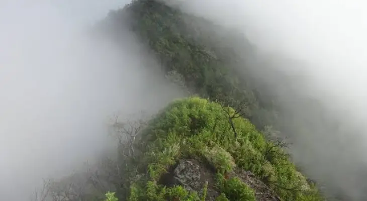
There are two main routes to the top namely from the Tepal Village route and from Marente/Marenteh, one of which is much easier than the other.
Mount Olet Sangenges can be climbed in one long day if you start before first light comes from the remote mountain village of Tepal Village (889 meters above sea level).
It is located southeast of the peak and is the closest village to the peak. The main problem was reaching Tepal Village via a very rough and muddy track for the last 20 kilometers after Punik.
Few people travel this remote road using jeeps or dirt bikes.
2. Starting Point of Climbing
Basically the distance from Sumbawa Besar to Tepal Village is about 55 kilometers, of which 33 kilometers is fine and 22 kilometers is very challenging.
Overall, a one-way trip can take between 3 to 5 hours. Beyond Punik, where the road splits into thick, steep mud and rocks, the views are delightful.
To the south of the highest pass there are the Batulanteh mountains, the highest of which is Olat Batupisak (1,763 meters above sea level) according to the Bakosurtanal map.
3. Passing a coffee plantation
Once in Tepal, and with a local guide, you can cycle, at least a dirt bike, a few kilometers further to extensive coffee plantations to a height of around 1,150 meters.
This took about 20 minutes and saved about an hour. After climbing, the path crosses a wooden fence (1,218 meters above sea level) before reaching a simple wooden hut on the left (1,220 meters above sea level).
This place was labeled 'Basecamp Rindu Tanjakan' by the previous group of climbers. Just beyond this point is a very important, unmarked left turn, off the main road.


Leave a comment